


PACK DIGIATLAS
Download up to 15 digital maps of your choice through a subscription to the 'Pack DigiAtlas'.
-Description:
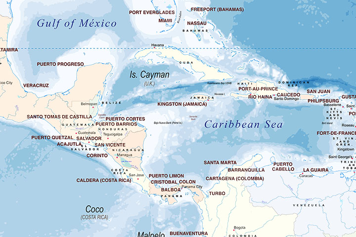
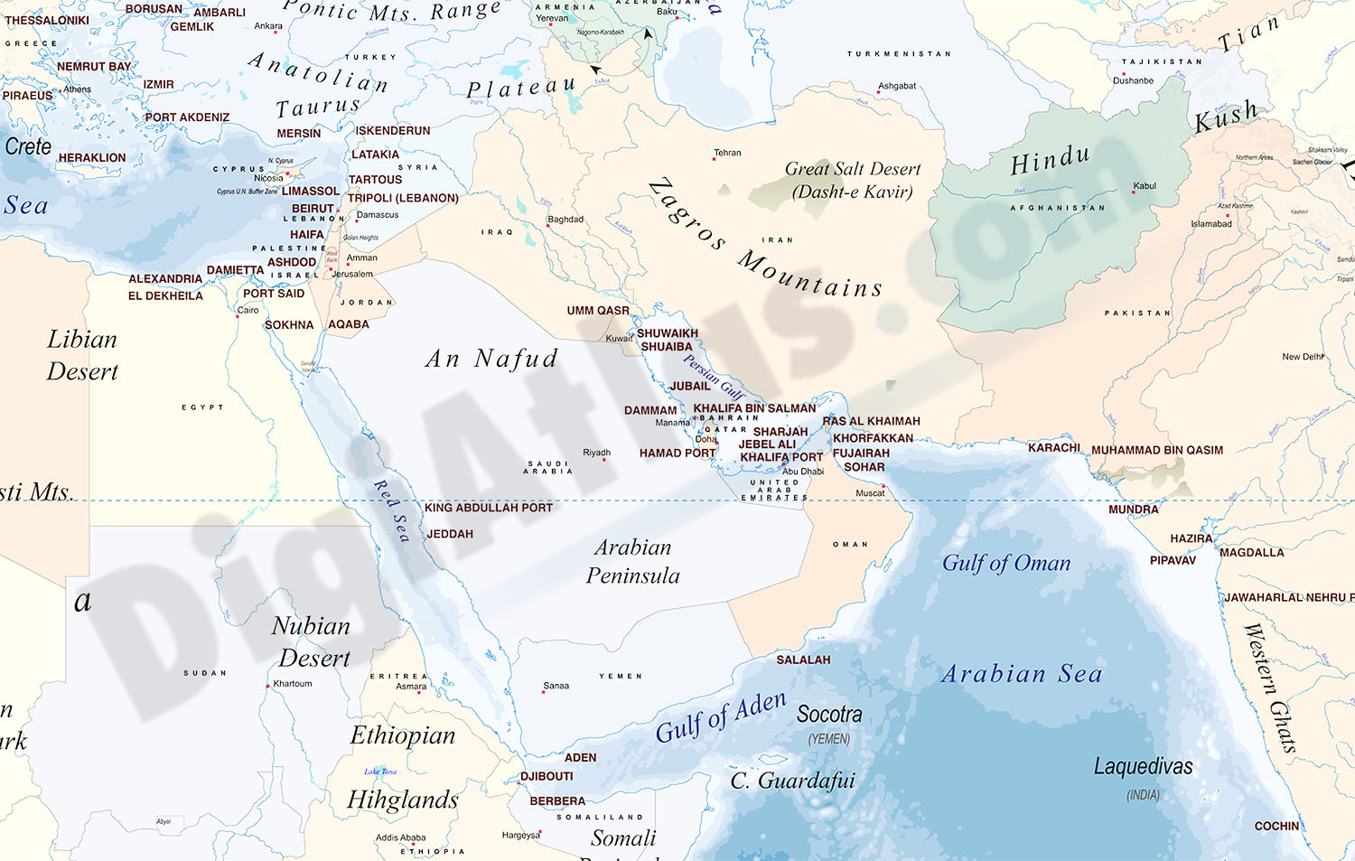
Physical-political digital world mapa with container ports.
The map shows coloured altimetry and bathymetry bands, country borders, capitals, major rivers and lakes, geographical names and the location of more than 340 of the world's busiest container ports.
Files are downloaded in 100% editable vector format, organised in separate layers so that colours, texts and graphic styles can be modified, in order to fully customise the look of the map.
Poster size world map for high quality printing.
-Original measurements:
300x200 cm (Fully resizable vector file for High-quality printing).
-Download formats:
Adobe Illustrator, Acrobat PDF
- This map is also available through the PACK DIGIATLAS »
-You can also request a quote » to modify this map and adapt it to your projects.
Download up to 15 digital maps of your choice through a subscription to the 'Pack DigiAtlas'.

Postcode maps of cities, regions and countries. Optionally with demographic data for geo-marketing projects.

City street maps with delineation of urban areas, streets, squares, parks, green areas, buildings of interest, etc.
DigiAtlas select every week until three random maps from their catalog and intends to offer them at a very lower price than its regular cost.
These maps change every 7 days. If either of them matches your interest take advantage of this opportunity to acquire digital maps to a very special price.