
POSTAL CODE MAPS
Digital mapping of postcodes in different formats.
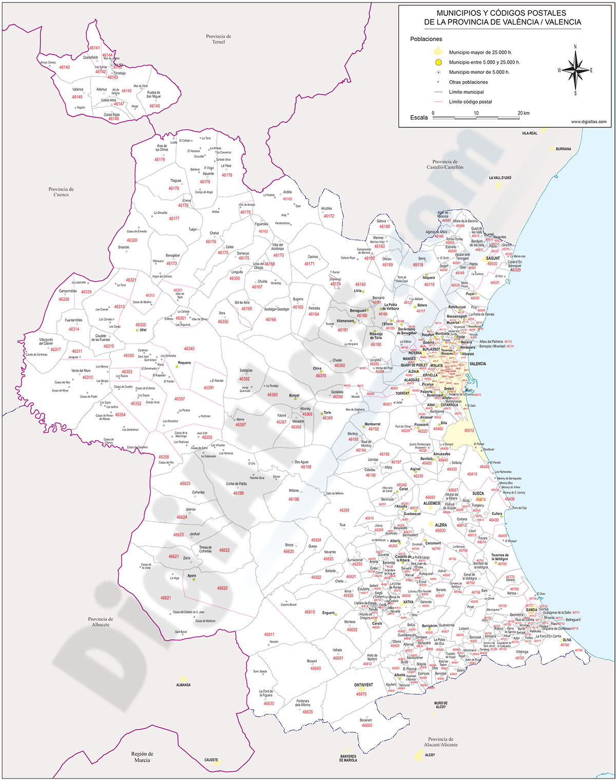

-DIGITAL MAPPING OF POSTAL CODES:
- DigiAtlas produces and offers digital postal code maps of countries, regions and cities around the world.
- All our maps and plans are available in various digital formats (Adobe Illustrator, Acrobat PDF, Shapefile, KML, etc.) and can be easily integrated into your existing systems or used as stand-alone tools.
- The maps are organized in different separate layers of information: administrative political division (regions, provinces, municipalities,...), capitals, cities and towns ordered according to their number of inhabitants and the boundaries of all postal codes from 2 to 5 or more digits.
- The organization in layers allows to visualize and/or hide different types of information to generate different and customized versions of the original maps.
- Choose the option that best suits your needs and start benefiting from the power of accurate location-based data.
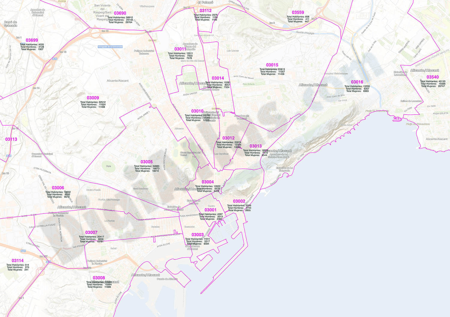
-NUMBER OF INHABITANTS OF EACH POSTAL CODE:
-Along with the georeferenced cartography or separately in an Excel file demographic data such as the total number of inhabitants, total men, total women and age groups (five-year groups) for each sex can be included.
-In addition, you will be able to download the files from a personalized page in DigiAtlas for a full year from the date of purchase, so you will always have the most up-to-date version of the zip codes and associated population data at your fingertips.

