
550,00 €
Maps of Spanish Provinces with Postal Codes
-Complete collection of postcode maps of ALL 50 Spanish provinces (plus Ceuta and Melilla) with
(...) Read more »
Adobe Illustrator, Acrobat PDF

Ask price
Maps of Spain with Postal Codes areas
Postal codes map of Spain
Georeferenced cartography of all postal codes in Spain (peninsula, Balearic Islands, Canary Islands, Ceuta and Melilla).
(...) Read more »
Shapefile format (.shp), KML

150,00 €
Map of Spain with all 5 digit postal codes
-Vectorised digital map of the whole of Spain with the 5-digit postcode areas and the boundaries and capitals of all the municipalities.
(...) Read more »
Acrobat PDF

79,00 €
Spain - postal codes by municipality and comarca
Complete Excel file with all the Postal Codes of Spain, along with the corresponding municipality, county and geographic coordinates. With 15,247 zip code areas, it is the definitive guide to l
(...) Read more »
Excel

79,00 €
A Coruña (Corunna) - Map of province with parroquias and postal codes
Map of the province of A Coruña (Galicia, Spain) with regional and provincial boundaries, coloured municipalities, parish boundaries and all postcodes.
Adobe Illustrator, Acrobat PDF

125,00 €
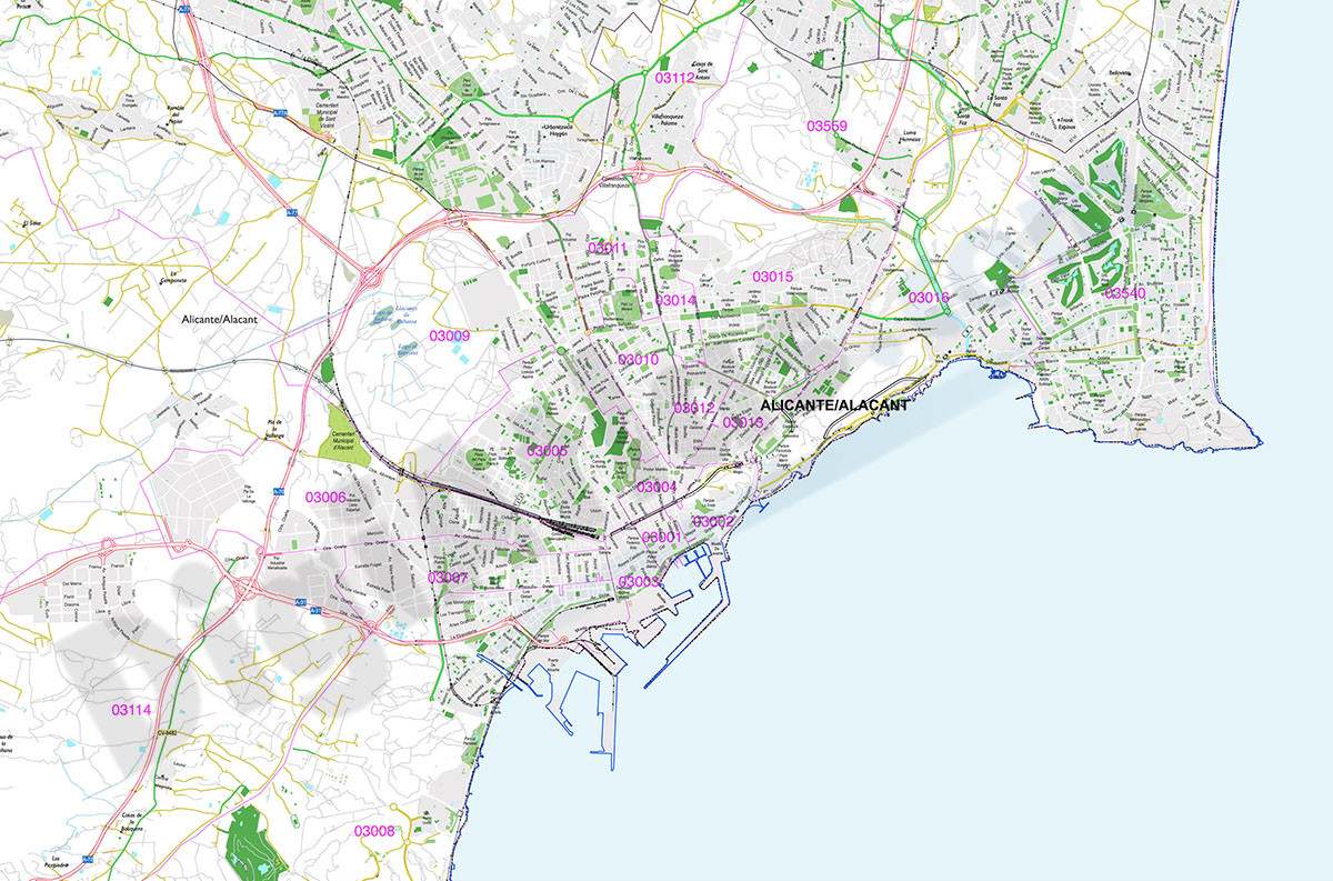
Alicante - provincial poster map with postcodes
Digital map of the province of Alacant/Alicante (Valencian Community).
Vector map of the whole province at 250x250 cm, in PDF format organised in separate layers, which can be displayed and/or hidden
(...) Read more »
Acrobat PDF

135,00 €
Andalusia - autonomous community map with municipalities and postal codes
Map of the 8 provinces of Andalusia (autonomous community in southern Spain) showing municipalities borders and 5-digit postal codes areas. Continuously Updated. Vectorized and fully editable formats.
Adobe Illustrator, PDF
