
PACK DIGIATLAS
Download up to 15 digital maps of your choice through a subscription to the 'Pack DigiAtlas'.

-DIGITAL MAPS OF CITIES AND URBAN AREAS:
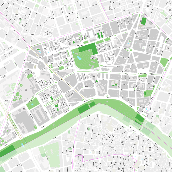
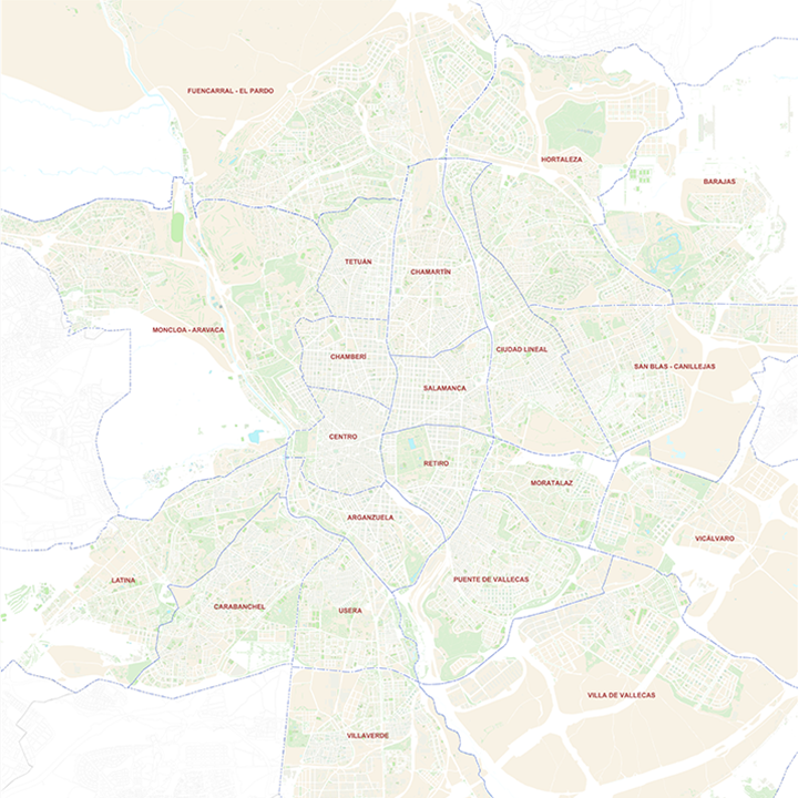
-Design and production of urban cartography in digital format. You can request plans of any capital city, town or village with the delineation and layout of its streets and squares, blocks of houses, parks and green areas, outstanding elements or buildings, etc. All with a personalised design with colours and names. Optionally you can include a text file with the street index.
-Like all our other maps, the street maps are available in various vector formats (Adobe Illustrator, Acrobat PDF, Shapefile, KML, etc.).
These files are organised in separate, fully editable layers. The organisation in layers allows you to visualise and/or hide the information to generate different and personalised versions of the original maps.
-The Adobe Illustrator (.ai) version is 100% editable and allows you to modify and customise colours, text and styles.
-The PDF version is suitable for direct printing of the map at the desired size.
-All maps can be converted into raster or JPG image format at high resolution (300 dpi) for direct printing at the desired size and always with the highest quality.
-The acquisition of the maps implies that the appropriate graphic applications must be available, in order to be able to edit the files.
-The maps are optimised for companies and graphic designers, allowing them to generate transport routes, advertising brochures, communication and marketing strategies, etc.
-The delivery of our maps in digital format does not imply any restriction to edit and print them. It is only forbidden to transfer or resell them to third parties in any kind of digital format.
-We offer a full guarantee of post-delivery corrections and access to free updates, from a personalised page on DigiAtlas, for a full year (365 days from the date of purchase).
Download up to 15 digital maps of your choice through a subscription to the 'Pack DigiAtlas'.

Postcode maps of cities, regions and countries. Optionally with demographic data for geo-marketing projects.
World maps, continents, countries,...
Road maps, tourist, school,...
And many other types of thematic mapping.